Uzungol
Uzungol is 99 km from Trabzon and 19 km from Çaykara district, at an altitude of 1090 m above sea level.
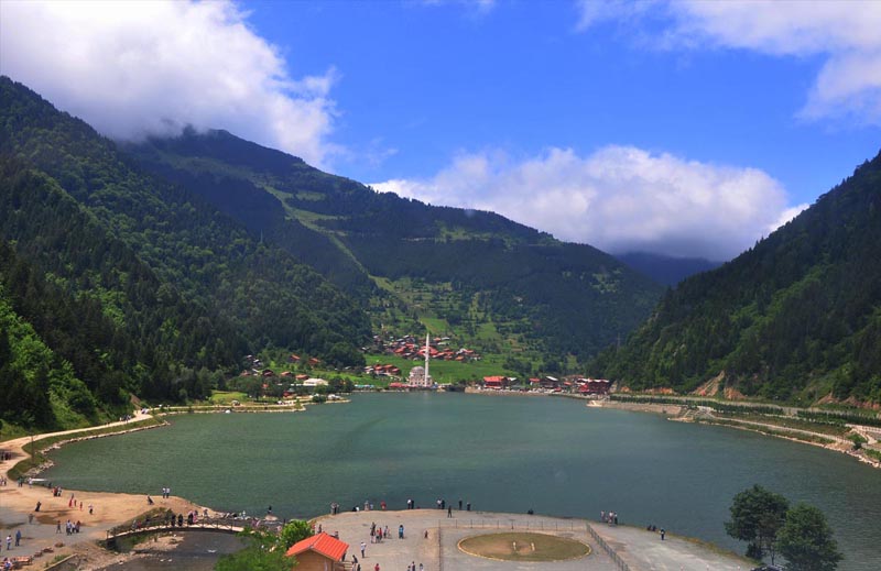
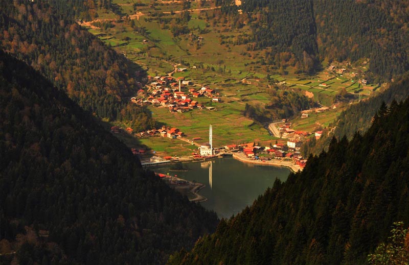
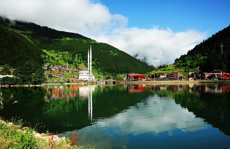
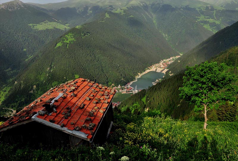
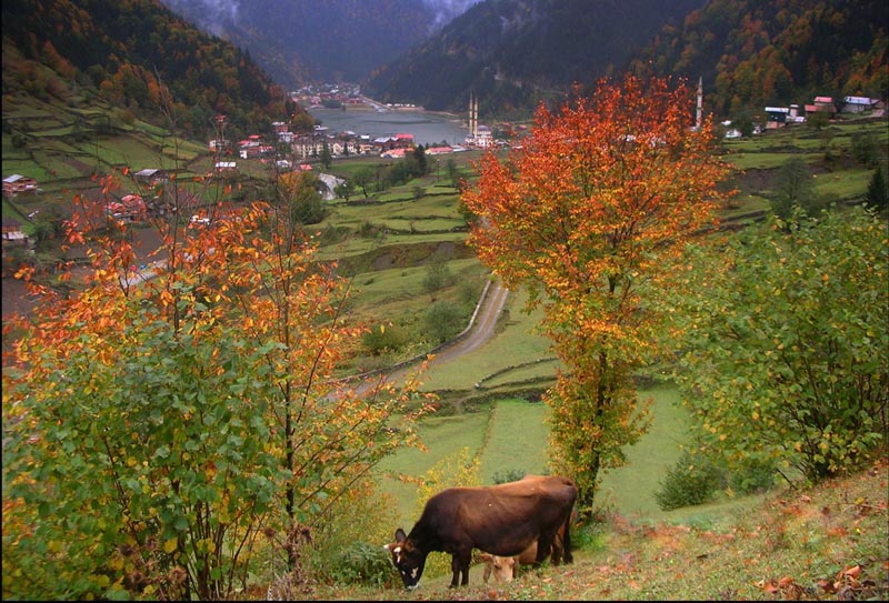
The lake, which was formed by the rocks falling from the slopes in the middle of the valley and blocking the Haldizen stream, is known as "Uzungol" and the environment has been given the same name. Especially the old wooden houses of the nearby village of "Şerah", built in a style suitable for the region, complement the beauty of nature.
Uzungol, which attracts great attention of local and foreign tourists, is very rich in terms of its touristic potential.
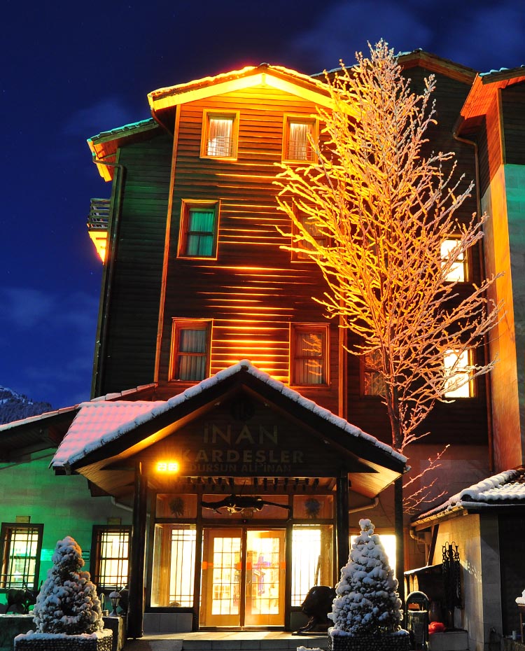
In addition to trekking, bird watching, and botanical tours for Uzungol Inan Kardesler, there are also trips to the lakes between the higher mountains or to other plateaus such as Şekersu, Demirkapı, Yaylaönü nearby.
In terms of wildlife, various animal species such as bear, wolf, wild goat, fox, Caucasian mountain rooster shelter in the mountains around Uzungol.
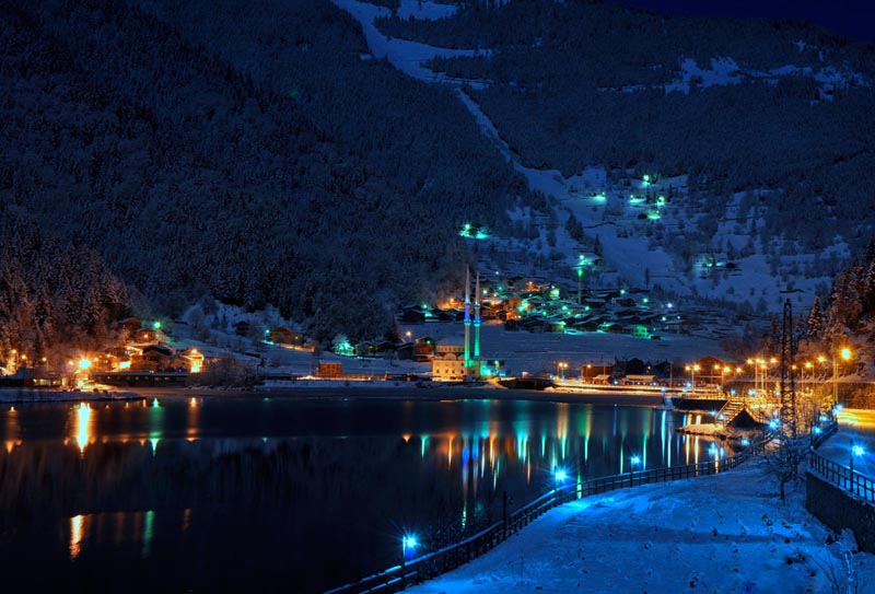
The lake, which was formed as a result of the closure of the stream bed as a natural dam as a result of the landslide in the Haldizen stream valley, exhibits an attractive landscape with the surrounding spruce forests, Uzungol settlement located on the lake shore has a municipal organization and infrastructure works are continuing.
It is stated that there is a 1/2000 implementation development plan prepared by the Municipality; It was observed that the traditional wooden plateau structures descend to the lakeshore in the form of concrete structures from their location on the meadow slopes in the northwest direction, and the concrete structures from their location on the meadow slopes in the northwest direction.
Although the water surface of the lake varies slightly depending on the amount of water coming in the season, it is generally 1000 meters in length, 500 meters in width and 15 meters in depth. Trout lives in the lake. The topography around the lake, which is the center of attention of the area designated as the Tourism Center, limits the settlement area.
For this reason, the tourism settlements determined in the northwest remain at lower altitudes due to the elevation difference. It is certain that the accommodation facilities that are considered to be located in these areas will want to use the lake and its surroundings intensively for daily activities and Uzungol Inan Kardesler activities. In this case, in order for the development of the Tourism Center to be healthy and successful, the development around the lake should definitely be kept under control.
The entrance of the lake from Çaykara direction is now closed with large buildings (mosque and school). In the area in the southeast, the development is rapidly increasing. The facility, which is built by the private sector, located in the south of the lake, next to the Haldizen stream, is a successful application consisting of wooden bungalows with 52 beds.
The Haldizen stream valley, which stretches towards the south, has great natural riches. About 10 to 20 km away from Uzungol, 10 small lakes at the heights of the mountains increase the richness of activity in the region. Even today, foreign groups come to Uzungol and stay in the existing facility and take walks in nature to the lakes in the south.
Geological Features
The western and southern parts of the Nature Park are surrounded by high mountains. The geological structures of the steep and steep slopes formed by these mountains towards the valley floor are generally volcanic interlayers and cretacea- shaped formations. High hills and continuous ridges consist of masses such as plutonic and crystalline schist, granite, diorite and acid crush . The bedrock is composed of clay and sandy shale. Basalts, which are formed by the latest volcanism and are the latest surface rocks, are found as bodies in older granite. Uzungöl İnan Kardesler . Basalts exposed mostly around Uzungol; They are hard, firm and durable, dark gray and blackish gray in color.10-10 m at the beginning of the lake. Thick new alluvium, pebbly sandy feature. 0.5 - 4.0 m. Standing on the steep slopes of the area thanks to the dense vegetation. There is slope debris of varying thickness in between. These slope debris flows in places.
Geomorphological Features
The main geomorphological unit in the Nature Park: It is a V-shaped valley and sharp ridges. The valley is very deep, the valley slopes are steep. However , there are sections with less slope that the Haldizen stream could not break down during the back erosion process. Uzungol is also located on such a plain. In the valley just in front of this plain, a broken slope draws attention.
It can be thought that the first effect in the emergence of the Uzungol basin was an old landslide mass on the northern slope of the lake. Due to the humid climate of the region, this landslide rupture site and even the traces of the sliding mass have been erased to a great extent. The large and angular blocks in the natural embankment, which provides the formation of the lake basin, must be the work of this landslide. However, the main factor in taking the lake basin to its present state is the accumulation cone that covers this landslide mass and developed on the southern slope of the Haldizen stream.
Climatological Features
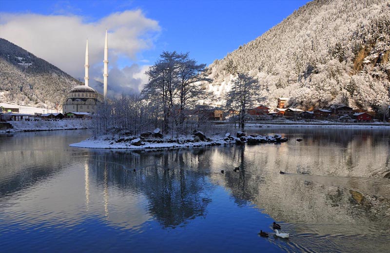
Within the general Black Sea climate, it has a distinct climate character under the name of the Eastern Black Sea climate. Summers are warm, humid and foggy, and winters are cool and rainy. Rainfall continues throughout the year. The highest monthly average temperature was 15.5 C in July, and the lowest average temperature was -1.8 C in February. The precipitation in the region; 28.30% in spring, 24.23% in summer, 25.32% in autumn and 21.65% in winter. Annual average precipitation is 881.6 mm . The month with the highest average precipitation is 104 mm. with May, the lowest month is 59.4 mm. is January with. Monthly average relative humidity of 78.8% d . The month with the highest relative humidity is August with 89.6% and the lowest is in January with 71%. Snowfall in Uzungol is usually seen between October and April. Snow stays on the ground for an average of 160 days a year and it falls mostly in January and February. Frost is seen between October and April. The dominant wind direction in the region is south and southeast.
Hydrogeological Properties
Uzungol is located on a relative plain in the Eastern Black Sea section, in the deep vedia opened by the Haldizen creek, which is a branch of the Solaklı creek, which originates from the Soğanlı Mountains and flows into the Black Sea near the district center of Of . The lake is fed by the waters of Demirkapı stream. The waters that pass the natural dam of the lake reach Solaklı creek, taking the name Haldizen creek. Uzungol valley, which has a deep and steep structure , is drained by the main stream and many side streams.
Soil Properties
Soil groups of the region are gray-brown podzolic and high mountain-meadow soils. Gray-brown podzolic soils are located in steep and shallow parts. In other parts there are podzolic soils.
Fauna
It has been determined that 20 mammals live in the forests surrounding Uzungöl . These; Ursus arctos (Bear), Rupicarpa rupicarpa (hook-horned mountain goat), Capreolurs capreolurs (Roe deer), Uzungol Inan Kardesler Canis lopus (wolf), Vulpes vulpes (Fox) Sus scrofa (wild boar), Meles meles (Badger), Martes martes (pine marten), pipistrellus pipistrellus (pipistrelle bat), Lepus europeaus (rabbit) d.
Uzungol Nature Park is also of great importance in terms of bird population . In the researches, 150 bird species were identified in Uzungol . 75 of them are local, 50 are immigrants and 14 are winter visitors. 11 species transit through the area.
Some important bird species in the Nature Park are: Lyrurus miokesiewiczi (mountain rooster), Anas crecca (Çamurcun), Buteo buteo (hawk), Tetraogallus caspius ( Urkeklik ), Anas platyhynchos (mallard duck), Hirunda rustica (swallow), Accipiter nissus (hawk), Ardea cinerea (gray heron).
Flora
Soil groups of the region are gray-brown podzolic and high mountain-meadow soils. Gray-brown podzolic soils are located in steep and shallow parts. In other parts there are podzolic soils.
The Eastern Spruce, which is the dominant tree species in the rich vegetation of the nature park , usually establishes a stand with eastern beech or pure . 157 plant species were identified as a result of the researches carried out in the Nature Park. The vegetation belonging to the region is divided into three groups as creek forest and alpine vegetation.
a) Stream Vegetation: Alnus glutinosa subsp.barbata (bearded red tree), Castanea sativa (Anatolian chestnut), Juglans regia (common walnut), Sambucus nigra (black elderberry), Acer cappodocicum (eastern Black Sea maple), Ulmus glabra (Eastern Black Tree).
b) Forest Vegetation: Abies nordmanniana subs.nordmanniana ( Eastern Black Sea Fir), Picea orientalis (Eastern spruce), Taxux baccata (common badger), Juglans regia (common walnut), Carpinus betulus (common hornbeam), Fagus orientalis (eastern beech), Quercus hartwissiana ( Persian oak), Ulmus glabra (eastern elm), Berberis vulgaris ; (common barberry), Rhododendron luteum (yellow flowering rhododendron)
c) Alpine Vegetation: Sedum spurium (roof grove), Astragalus sp. (Agave), Galium palustra (yogurt grass), Silene alba , silene vulgaris , silene compacta (sticky grass).